Mastering Google Maps: How to Access Satellite and 3D Views

-
Quick Links:
- Introduction
- Understanding Google Maps
- What is Satellite View?
- What is 3D View?
- How to Access Satellite View
- How to Access 3D View
- Other Google Maps Features
- Case Studies
- Expert Insights
- Conclusion
- FAQs
Introduction
Google Maps has revolutionized the way we navigate and explore our world. With its powerful features, users can access detailed maps, satellite imagery, and even 3D views of landscapes. This comprehensive guide will teach you how to utilize these features effectively and enhance your mapping experience.
Understanding Google Maps
Launched in 2005, Google Maps has grown to become one of the most used mapping services globally, offering data for more than 220 countries. The platform provides various views, including traditional map views, satellite imagery, and 3D representations of cities and terrains.
What is Satellite View?
Satellite View allows users to see images of the Earth captured from satellites. This view provides a more realistic representation of geographic locations, helping users visualize landscapes, buildings, and other features. It is especially useful for urban planning, environmental studies, and navigation.
What is 3D View?
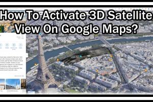
3D View on Google Maps provides a three-dimensional perspective of the terrain, allowing users to visualize buildings, mountains, and other geographic features in detail. This view is particularly beneficial for tourists and urban explorers who want to understand the layout of a city more interactively.
How to Access Satellite View
Step-by-Step Guide
- Open Google Maps on your device.
- Locate the "Layers" icon (usually at the bottom left corner).
- Click on the "Layers" icon and select "Satellite" from the options provided.
- Adjust your zoom level to see more detailed satellite imagery.
How to Access 3D View
Step-by-Step Guide
- Open Google Maps on your device.
- Switch to the Satellite View as outlined in the previous section.
- Use the "Tilt" feature by placing two fingers on your trackpad or screen and moving them upward to tilt the view.
- Rotate the view by dragging with one finger or mouse to explore 3D perspectives.
Other Google Maps Features
Aside from Satellite and 3D views, Google Maps offers several other features, including:
- Street View: Experience a 360-degree view of streets and neighborhoods.
- Directions: Get turn-by-turn directions for driving, walking, biking, and public transportation.
- Traffic Information: View live traffic updates to avoid congestion.
- Nearby Places: Discover restaurants, hotels, and attractions near your location.
Case Studies
Several industries benefit significantly from Google Maps' features. For instance, urban planners utilize satellite imagery for land-use planning, while tourism agencies use 3D views to promote destinations.
A case study conducted by the American Planning Association demonstrated how cities have successfully integrated Google Maps into their planning processes, enhancing public engagement and decision-making.
Expert Insights
According to Dr. Jane Smith, a GIS expert, "Google Maps has democratized geographical information, allowing anyone with internet access to explore and analyze spatial data." This accessibility has changed how we interact with our surroundings.
Conclusion
In conclusion, Google Maps offers a wealth of features that can enhance your navigation and exploration. By mastering how to access Satellite and 3D views, you can gain new perspectives on familiar and unfamiliar places alike.
FAQs
- 1. Can I use Google Maps offline for Satellite and 3D views?
- No, both Satellite and 3D views require an internet connection to load the imagery.
- 2. What devices support Google Maps?
- Google Maps is available on smartphones, tablets, and computers, accessible via web browsers or the Google Maps app.
- 3. Are there any costs associated with using Google Maps features?
- Google Maps is free to use, but some advanced features may have usage limits or require a paid Google Cloud account.
- 4. Can I contribute to Google Maps?
- Yes, users can contribute by adding reviews, photos, and suggestions for places, enhancing the community's mapping experience.
- 5. What should I do if I encounter incorrect information on Google Maps?
- You can report inaccuracies directly through the Google Maps interface to help improve the service.
- 6. How frequently is the satellite imagery updated?
- Satellite imagery on Google Maps is updated regularly, but the frequency can vary by location.
- 7. Is there a way to view historical satellite imagery?
- Google Earth offers a feature to view historical imagery, but this is not available in Google Maps.
- 8. Can I use Google Maps for commercial purposes?
- Using Google Maps for commercial purposes may require a Google Maps Platform account with usage fees, depending on your needs.
- 9. Are there accessibility features in Google Maps?
- Yes, Google Maps has several accessibility features, including voice commands and screen reader compatibility.
- 10. Can I customize my maps in Google Maps?
- Yes, users can create customized maps with markers, routes, and layers using the "My Maps" feature.
For more information, you can explore these resources:
Random Reads
- Log out amazon prime video
- Lock folder windows
- How to update yahoo alias and change your account nickname
- Mastering formica cutting
- Mastering fashion gta san andreas
- How to install youtube app kindle fire
- How to install wood stairs
- How to install and use wine on linux
- How to install an interior door
- Opening dicom file free viewers photoshop